Isle Royale

Isle Royale is an archipelago made up of 400+ islands located in Lake Superior. I first learned about it in 2020 while looking up national parks near me and became fascinated with its unique story and landscape and the fact that I had never really heard of it before.
Isle Royale is the least visited national park in the lower 48 states, only accessible by boat or seaplane and uninhabited by humans for half the year from November-April. Thru-hiking Isle Royale has been a dream of mine for the past 5 years but a few things kept me from pursuing this dream — mainly that I have no experience backpacking.
I knew that in order to go I needed to find good people to go with, to teach me and support me as a newb backpacker. My friends Molly and Laura truly were so kind, taught me so much and carried most of this trip on their backs (literally!)
I don’t want this to be too long-winded of a post, but I do want to go over our trip’s itinerary day-by-day and hopefully offer some insight and help for those wanting to pursue a similar adventure.
First things first…
Right from the get go of planning this trip (back in January) we discovered planning a thru-hike on Isle Royale is not a simple task. There are a lot of factors to plan for and things you need to think through months before your trip begins. This includes:
Boat/Plane: There are a few different boats/ferries that are open to the public, either leaving from Minnesota or Michigan. However they only operate on certain days in certain directions so you will want to plan accordingly. You can book a plane any day, however the cost of your trip will go up quite a bit with this option and weather is more likely to disrupt plans day of. Whichever option you go with, you want to book as soon as possible as spots are extremely limited. There are no one-way tickets to the island.
Cost of entry: It’s $7/day per person OR $60 for a season pass that permits up to 4 people. You need to buy your pass (whichever you choose) before arrival on the island. We did a season pass (so technically I could go again this year…)
Permits: You will need to obtain a permit from a ranger to stay overnight on the island, however you do this when you arrive (or on certain ferries to the island.)
Travel days: You will most likely need to account for travel days and lodging at the beginning and end of your trip.
Water: It’s recommended that you double treat your water while backpacking, be prepared by obtaining a filtration system and enough iodine tablets to treat your water. We double treated all inland lake water and only filtered Lake Superior water.
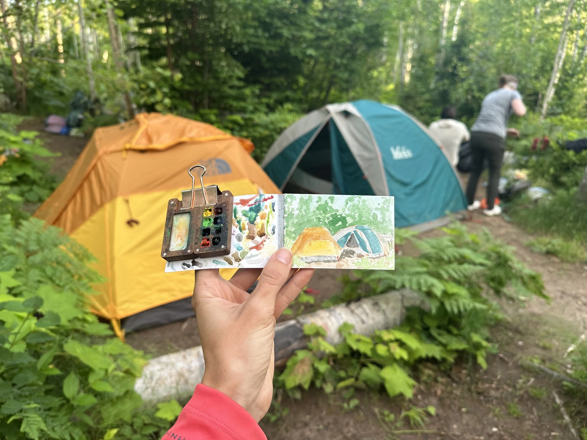
Day One: Grand Portage to Windigo to South Lake Desor

After traveling from Minneapolis to Grand Portage and staying at the casino the night before, we took the Voyageur II out to Windigo. It’s a 2 hour ride and the weather was so lovely. Almost as soon as we left the harbor in Minnesota we could see Isle Royale in the distance.
Arriving at Isle Royale was such a joy, so many beautiful islands to look at from the boat! After a brief orientation from a ranger and obtaining our permit for the week we set out on our 11.3 mile hike to South Lake Desor on the Greenstone Ridge trail.
This hike ended up being about 12 miles somehow and also summits the highest point on Isle Royale (Mount Desor) so there was quite a bit of elevation gain.
Day Two: South Lake Desor to Hatchet Lake
Continuing on the Greenstone Ridge trail, we hiked 8.1 miles to Hatchet Lake. For most of day one and two’s hikes we didn’t see much aside from greenery and rocky terrains, however at the end of this hike right before descending to our campsite we got some spectacular 360 degree views of Lake Superior.
Day Three: Hatchet Lake to West Chickenbone

Still on the greenstone, we hiked 7.9 miles to West Chickenbone Lake. We had heard some things about this campsite not being the best but… it was stunning. No moose or wolf sightings aside from tracks in the mud, but at this site we had a snowshoe hare try to join us for dinner.
Day Four: West Chickenbone to Daisy Farm

This day was wet and then… more wet. We started out dry but within a .5 mile of our 7.9 mile hike we had our rain gear on and didn’t take it off till the end. Torrential rains flooded the trail making even some of the boardwalks float. We didn’t need to use our filtered water to rehydrate our yogurt… we just let the rain do the job. All of our boots were completely drenched within that first mile as well, not to dry off until a few days later. Along this portion of the hike we knew there were some beautiful overlooks, and got to see some of them through the fog. However no photos were taken and these moments live on only in our memory… which honestly is more sacred anyway.
We arrived at Daisy Farm (more of an 8.5 mile hike than 7.9 like the map says…) right as the rain stopped and found a shelter by… Lake Superior! We finally made it to the big lake after hiking mainly inland for the duration of our trip.
Day Five: Zero Day at Daisy Farm

We couldn’t have planned it better to have a zero day after our rainy day. We got some well deserved rest and were able to dry off most of our clothes this day, and finally jump in the lake, too. We made a lot of friends at this campground and got to attend a moose and wolf talk with Candy and Rolf Peterson at the dock.
Day Six: Daisy Farm to Rock Harbor

Our final hike was 9.4 miles along the rock harbor trail which is right along Lake Superior. This was by far the easiest hike of the trip as there was little elevation gain and so much beauty to behold. Before we knew it, we arrived at Rock Harbor back to civilization (and burgers.. and an $8 shower.)
We also chose to hike out to Scoville Point to complete our journey from the furthest western to the furthest eastern points of the island. An additional 4 miles to our day.
Day Seven: Rock Harbor to Grand Portage
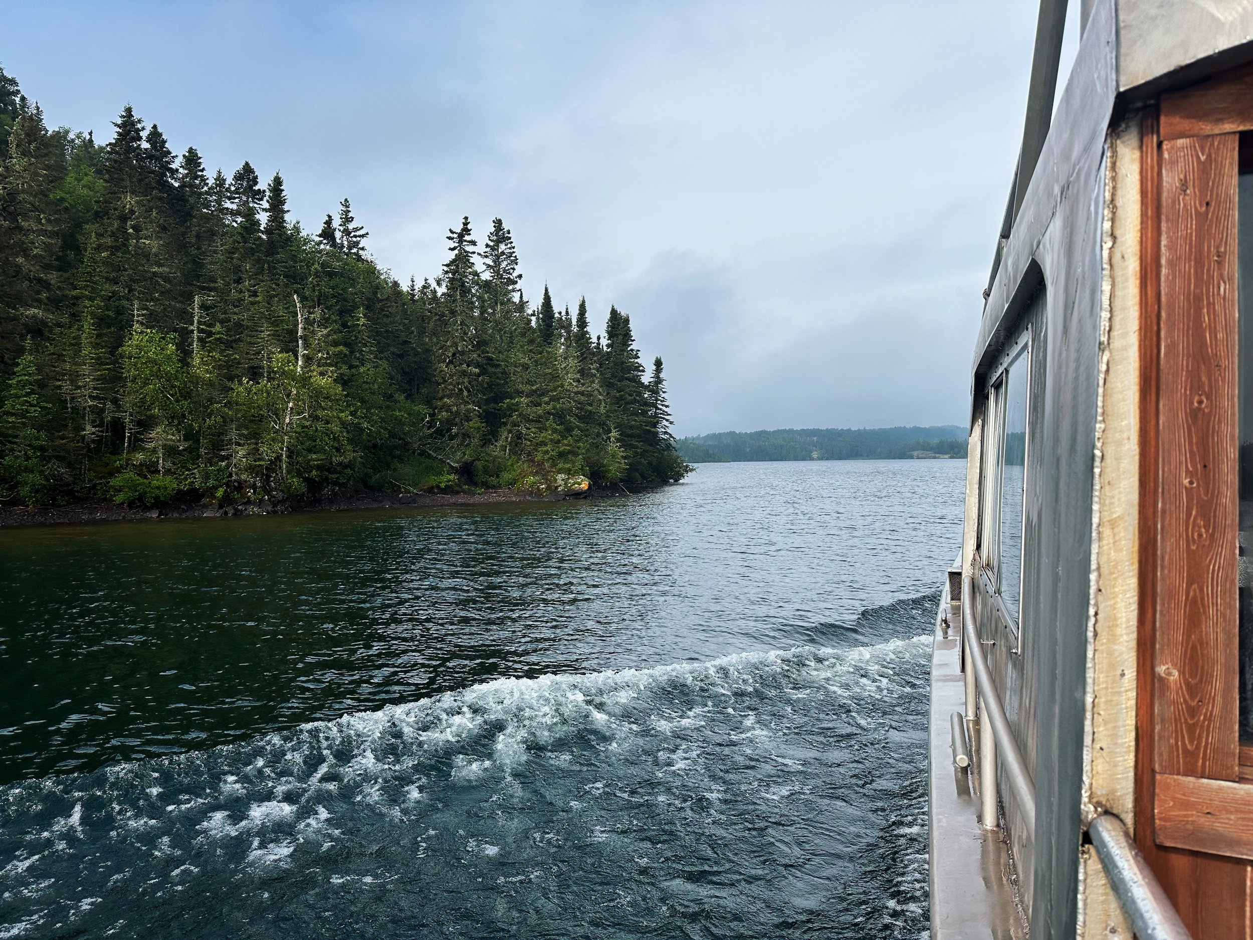
This boat ride was just over 8 hours long, covered most of the southern side of the island and was absolutely beautiful.
After arriving back to mainland Minnesota we drove to Grand Marais where we spent the night before driving back home to Minneapolis the following day.
In Conclusion…
This was one of the best trips I have ever been on and I most definitely would like to go back to Isle Royale someday (very soon!)
I will say that I probably won’t thru-hike it again. While it was so rewarding to thru-hike, it also was so… not by Lake Superior. I would love to go back and explore the various coasts of the island (and maybe the other islands and shipwrecks around it.)
If you do decide to thru-hike I would highly recommend starting from Windigo and ending at Rock Harbor. Multiple times on our journey we mentioned how glad we were that we went this direction. Your views get better and better as you go from Windigo to Rock Harbor and your hikes get easier and easier.
Thanks for reading! If you have any questions about planning your own trip in future, please reach out. It felt so complicated to figure out at first, I’d love to share the knowledge we learned on our journey.